

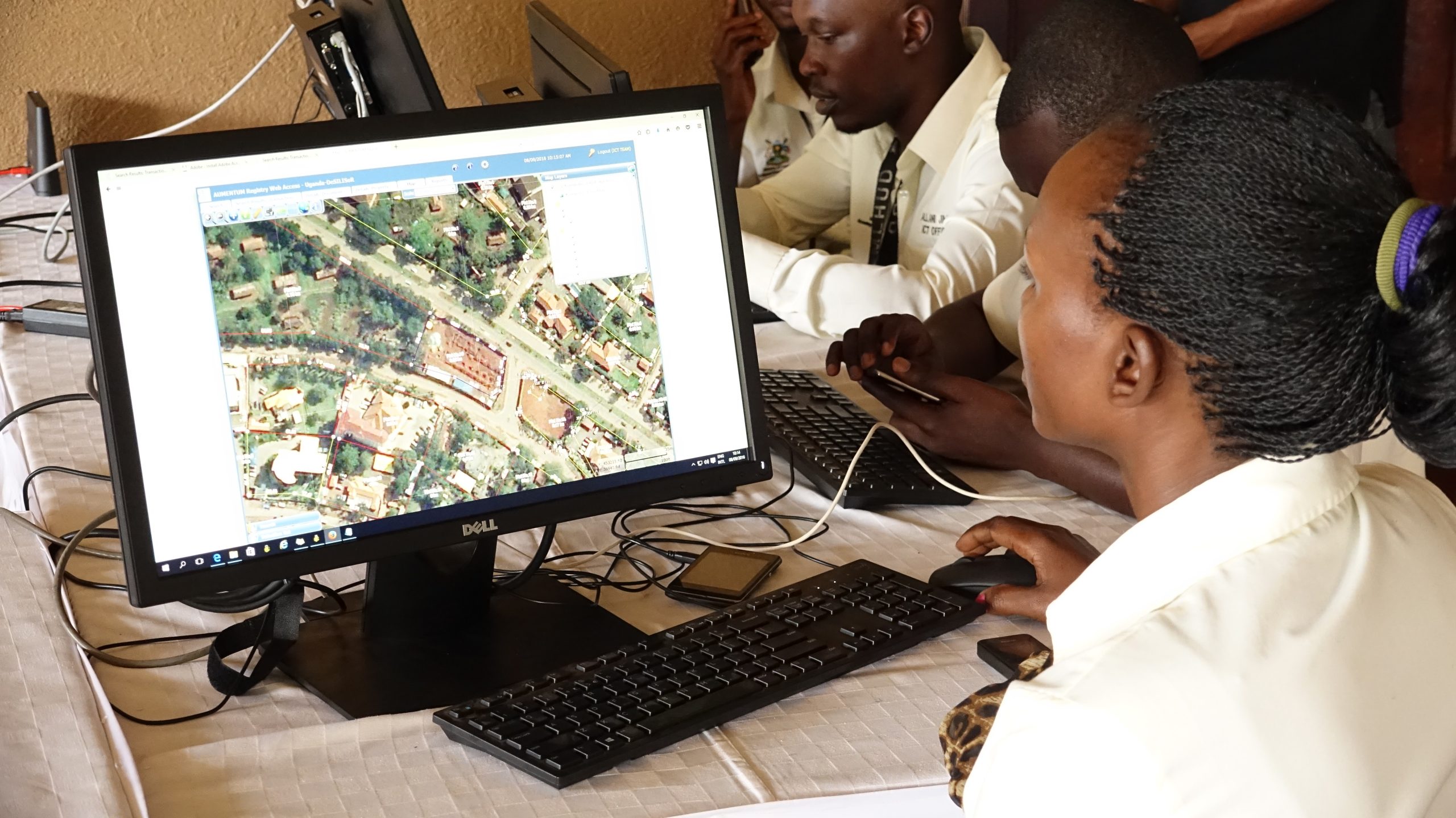
The Uganda National Land Information System (UgNLIS) is specifically designed to manage the spatially referenced land registration, valuation, planning and administration related data across Uganda in accordance with legislation, procedures and techniques for the systematic collection, update, processing and distribution of this data.
The UgNLIS is the most comprehensive land information system implemented in Africa to date and the result of efforts to improve the country’s land sector that stretch back over the past three decades. The groundwork preparations for the implementation of the UgNLIS commenced with the 1995 Constitution that contained a number of provisions on Land Administration. A key legal provision was the Land Act enacted in 1998.
The 10 year Land Sector Strategic Plan (LSSP) was developed following a thorough review of the 1998 Land Act. A number of strategies were adopted under the LSSP to review Uganda’s policy and legal framework, protect the rights of vulnerable groups, improve land service delivery through the modernization of the land registry and support to the decentralization of land administration institutions, provision of public information on land rights, development of strategies to protect the rights of vulnerable groups and the development of a National Land Policy among other things.
 The pilot phase of the NLIS was implemented by the Government of the Republic of Uganda Ministry of Lands, Housing and Urban Development (MLHUD) with support from IGN FI and funded by the World Bank from 2010 to 2013 in accordance with the objectives of the LSSP. The Design, Supply, Installation and Implementation of the Land Information System and Securing of Land Records (DeSILISoR) Project comprised the initial development of the Uganda National Land Information System (UgNLIS); the design and implementation of digital processes for land registration; the digital conversion of over 550 thousand freehold, leasehold and mailo titles; the integration of these digitized titles into the system; and the establishment of 6 Ministry Zonal Office (MZOs).
In 2013, the Government of Uganda initiated the Land Sector Strategic Plan II (LSSPII) 2013-2023 to: 1) comprehensively restore the integrity of Uganda’s Land Registration system, 2) modernize and enhance the ability of the land sector to deliver services commensurate with the needs of the economy, 3) establish a modern Land Information System and Land Records Archiving system, 4) develop the institutional capacity and human capital required to ensure inclusive access, equity and social justice, 5) decentralize land services closer to the people, and 6) eliminate land-based constraints to Uganda’s private sector competitiveness to encourage investment and contribute to overall National development. Under the LSSP II and following the success of the DeSILISOR pilot project, the Government of Uganda took the UgNLIS to scale with the roll-out of a national system under the Design, Supply, Installation and Implementation of National Land Information System Infrastructure (DeSINLISI) Project.
 This project was again supported by a consortium led by IGN FI with support from the World Bank. The DeSINLISI Project implemented between February 2015 and February 2020 involved the national roll-out of the UgNLIS to fully integrate land registration, land administration, surveying and mapping, physical planning, property valuation and to finalize the process of transforming land records into digital format. The computerized system decentralized land governance with the establishment of 22 self-contained one stop Ministry Zonal Offices (MZOs) across the country and demonstrated a significant impact on the strengthening land tenure security, reducing corruption, consolidating revenue, improving service delivery.
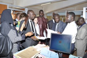
The Ugandan UgNLIS represents an ideal model for the implementation of a functioning UgNLIS. Government delegations from across Africa including Tanzania, Kenya, Ethiopia, Malawi, Mali, South Sudan and Djibouti have visited Uganda to witness the implementation of the NLIS as they explore ways to overcome their respective land governance challenges and implement similar national systems.
The third phase in the establishment of the UgNLIS comprised of the enhancement of the system referred to as the National Land Information System Enhancement Project (NALISEP) commenced in October 2023.
 Benefits of the UgNLIS
Key benefits of the UgNLIS include:
• Applies to freehold, leasehold, mailo titles
• Incorporates functionalities for valuation assessments, physical planning and district land management decisions,
• Prevents encroachment on wetlands, forests, road reserves and other public land reserves,
• Reduces the time required to check, update and transfer land,
• Increases the security of land tenure,
• Contributes to a reduction in corruption associated with checking, updating or transferring of titles,
• Delivers services closer to the public.
NATIONAL LAND INFORMATION SYSTEM ENHANCEMENT PROJECT (NaLISEP)
The UgNLIS is also being enhanced under the National Land Information System Enhancement Project (NaLISEP) implemented from October 2023 to May 2024 by IGN FI with support from the World Bank. The main objectives of the NaLISEP comprise:
• Enhancement of the public portal, including ability to manage the payment of fees and stamp duties and to pay online if desired, and commence online transactions. development of e-payment gateway
• Deployment of corporate portals for the digital integration of professions related to the land, in particular surveyors
• Development of Mobile APP for smartphones (iOS & Android),
• Enhancement of the integration of other Ministries or agencies (MDAs) using the NITA-U instituted UgHUB, in particular with URA to make the MLHUD a one stop in matter of payments related to Land, and with the Judiciary to share digital information with MLHUD
• Development of a digital process to permit the massive registration for the large adjudication projects the MLHUD in undertaking Integration of CCOs issued by recorders in the subcounties into the UgNLIS, to enhance their security avoiding the registration of overlapping lands in other tenures
• Implementation of digital auto-assignment of plot numbers and a conversion methodology for the existing Kalamazoos thus replacing them by their digital version
• Other enhancements to digital registration and cadastral processes and to security features of the UgNLIS
Ministry Zonal Offices
The UgNLIS comprises of 22 self-contained one stop Ministry Zonal Offices (MZOs) across Uganda in:
• Arua
• Gulu
• Kabale
• Kabarole
• Kampala
• Kibaale
• Jinja
• Lira
• Luwero
• Masaka
• Masindi
• Mbale
• Mbarara
• Mityana
• Moroto
• Mpigi
• Mukono
• Rukungiri
• Soroti
• Tororo
• Wakiso Busiro
• Wakiso Kyandondo